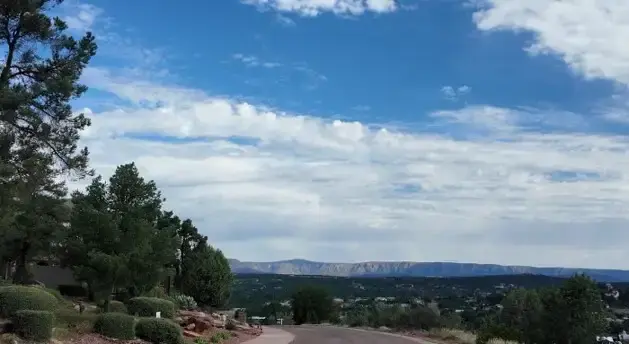
Payson and the Mogollon Rim under summer clouds. Local terrain and monsoon runoff are part of the broader flood-risk picture in Rim Country.
If you’re buying a home or land in Payson, Arizona, one question worth investigating is whether the property is located in or near a mapped floodplain.
Even in Arizona’s high country, flooding can occur. Payson and the surrounding Rim Country contain washes, drainage channels, creeks, and low-lying areas that can carry significant amounts of water during monsoon storms and other heavy precipitation events.
Fortunately, buyers and property owners can use official government resources to research flood zones and floodplain information for properties in Payson and throughout Gila County.
How Do I Find the Flood Zone for a Property in Payson, Arizona?
A good place to start is FEMA’s Flood Map Service Center. FEMA describes the Flood Map Service Center as the official online source for flood hazard information produced under the National Flood Insurance Program. You can search by address and view the flood mapping available for the property.
When evaluating a particular property, don’t rely solely on a general map of the Payson area. Flood zones can vary from parcel to parcel, and the location of a home or other improvement within a parcel can also matter.

Example of FEMA flood mapping for the Payson-Star Valley area. Buyers should open the live FEMA Flood Map Service Center for the current map applicable to a specific property.
What Do FEMA Flood Zones Mean?
FEMA maps use flood-zone designations to identify different levels and types of flood hazard. Special Flood Hazard Areas generally represent areas with at least a 1% annual chance of flooding – sometimes called the ‘100-year floodplain.’ That phrase can be misleading: a 1% annual chance does not mean flooding can occur only once every 100 years.
Depending on the location, a buyer may encounter FEMA designations such as Zone A, AE, AO, or Zone X. A property’s mapped designation can affect development review, lending, and flood-insurance considerations. The designation for the specific property should be verified rather than inferred from nearby properties.
Arizona Floodplain Management Viewer
The Arizona Department of Water Resources (ADWR) offers an online Floodplain Management Viewer that can help you review floodplain information. ADWR is Arizona’s state coordinating agency for the National Flood Insurance Program and works with local agencies on floodplain management across the state.
Gila County Floodplain Information
Gila County regulates floodplains within its jurisdiction under its Floodplain Management Ordinance. The ordinance incorporates FEMA’s Flood Insurance Study and Flood Insurance Rate Maps and also provides for other regulatory floodplain delineations, including administrative floodplains and accepted engineering studies.
This can be especially helpful when researching property outside incorporated Payson, including northern Gila County locations where washes and drainage channels may affect individual parcels. If you’ve any questions regarding development or permits, you must contact the applicable floodplain administrator or local government directly.

A rocky creek channel in the Christopher Creek area shows how water naturally concentrates in defined drainage paths through Rim Country terrain.
Don’t Confuse a Wash With a FEMA Flood Zone
One important distinction for Rim Country property is the difference between seeing a wash or drainage feature on or near a property and determining that the property is within a FEMA-designated Special Flood Hazard Area. They are not necessarily the same thing.
Likewise, a property that is not within a FEMA Special Flood Hazard Area is not necessarily free from all flooding or drainage risk. Arizona monsoon storms can produce substantial runoff over a relatively short period. Local topography, drainage patterns, culverts, washes, slopes, and previous development can all be relevant when evaluating an individual property.

A roadway culvert in the Payson area illustrates how stormwater drainage can move through developed neighborhoods even outside a visible creek channel.
Practical buyer tip Use the current FEMA map as a starting point, but investigate the actual property conditions when a parcel is near a creek, wash, drainage channel or low-lying area. |
What is the 2026 Gila County Flood Map Update
On April 28, 2026, Gila County shared an update on FEMA’s flood mapping work in the county. FEMA Region 9 had finished mapping several washes that had been studied before. The County and local communities had also sent in their comments, and the maps were moving into the public review stage.
According to the County’s update, preliminary maps are expected after the public-comment period, followed by a formal appeal period. The County stated that the overall process can take up to two years or more before updated maps take effect.

A broad drainage corridor running through a developed Payson-area neighborhood. A visible wash and a FEMA-mapped flood zone are related concepts, but they are not necessarily the same thing.
Why this matters A buyer researching property today should distinguish between the currently effective FEMA mapping and proposed or preliminary mapping that could affect the property in the future. Proposed mapping should not automatically be treated as the currently effective flood-zone designation. |
Does Being in a Flood Zone Require Flood Insurance?
Not in every transaction. Flood-insurance requirements can depend on the property’s flood-zone designation, the lender, the type of financing, and other circumstances. Federally regulated or insured lenders generally require flood insurance for buildings securing a loan when they are located in certain Special Flood Hazard Areas.
Cash buyers are not subject to a mortgage lender’s insurance requirement, but that does not mean flood risk should be ignored. Buyers should confirm insurance availability, pricing, and coverage with a qualified insurance professional and confirm loan requirements with their lender.
What If I Think FEMA’s Flood Map Is Wrong?
Flood maps can be revised. ADWR explains that a property owner who believes a property has been mapped incorrectly may be able to pursue a FEMA Letter of Map Change (LOMC).
Depending on the circumstances, this can include a Letter of Map Amendment (LOMA), Letter of Map Revision (LOMR), or Letter of Map Revision Based on Fill (LOMR-F).
These processes generally require appropriate technical information, and the services of an Arizona-licensed civil engineer or land surveyor may be appropriate.
Buying Property Near a Creek or Wash in Rim Country
Properties near water and drainage features can be some of the most attractive real estate in the Payson area, but they deserve additional investigation.
For properties near Tonto Creek, Christopher Creek, the East Verde River, Webber Creek, seasonal washes, or other drainage features, buyers may want to investigate:
- The current FEMA flood-zone designation

Creekside property in Christopher Creek. Buyers might find homes near creeks and washes attractive, but they should check the flood mapping, drainage patterns, insurance, and development restrictions for the specific parcel.
- County or municipal floodplain information
- Existing and proposed flood mapping
- Drainage patterns across the property
- Flood-insurance availability and cost
- Known prior flooding or drainage issues
- The location of structures relative to mapped flood areas
- Permits and development restrictions applicable to the parcel
The appropriate level of investigation depends on the individual property and the buyer’s intended use.
Town of Payson Floodplain and Engineering Resources
For property within the Town of Payson, the Town’s Engineering Division is another useful resource. The Town states that the division is involved with storm-water systems and floodplain administration, reviews private development plans, and maintains street, topographic, and aerial maps.

A dry stormwater channel entering a roadway culvert in the Payson area. Local drainage infrastructure can be relevant when evaluating a property near a wash or low-lying area.
Official Floodplain Resources for Payson and Rim Country
Need Help Researching a Payson-Area Property? Trust Dennis Riccio
Floodplain mapping is only one part of researching real estate in Arizona’s Rim Country. I, Dennis Riccio, help buyers evaluate property in Payson, Pine, Strawberry, Star Valley, Christopher Creek, and the surrounding communities. My goal is to help identify the questions that should be investigated so buyers can make informed decisions about the property they’re considering.
If you’re considering buying or selling property in the Payson area, feel free to give me a call at (928) 517-4550!
Dennis Riccio, REALTOR®
Rim Country Real Estate Specialist
Payson, Arizona
Important notice This information is provided for general real-estate educational purposes and is not a floodplain determination, engineering opinion, insurance opinion, or legal advice. Flood maps and regulations can change. Buyers and property owners should verify current information with FEMA, the applicable governmental authority, their lender, insurance professional, and appropriate licensed professionals. |
Frequently Asked Questions
1. How do I check whether a Payson, Arizona property is in a flood zone?
First, enter the property’s address in FEMA’s Flood Map Service Center. You can also check the Arizona Department of Water Resources floodplain maps. If you still have questions about a specific property, contact the local floodplain administrator.
2. Is every wash in Payson considered a FEMA floodplain?
No. A visible wash or drainage channel does not automatically mean the property is within a FEMA Special Flood Hazard Area. Local drainage features can still be relevant even when FEMA mapping does not place the parcel in a high-risk zone.
3. Are Gila County flood maps being updated?
Yes. Gila County said in April 2026 that FEMA Region 9 had finished mapping washes that were studied earlier. The maps were then moved into public review. Preliminary maps and a formal appeal period will come next, before any updated maps take effect.
4. Does a home in a FEMA flood zone always require flood insurance?
No. It depends on the property’s flood-zone designation, how the home is financed, and the lender’s requirements. Buyers should check with their lender and insurance professional to find out what applies to the property.
5. Can a FEMA flood-zone designation be changed?
In some circumstances. FEMA has Letter of Map Change processes, including LOMA, LOMR, and LOMR-F. Technical information and assistance from a qualified engineer or land surveyor may be required.
6. Where can I get local floodplain information for property inside Payson?
The Town of Payson Engineering Division handles functions that include storm-water systems and floodplain administration. For property outside incorporated Payson, Gila County floodplain resources may be applicable.